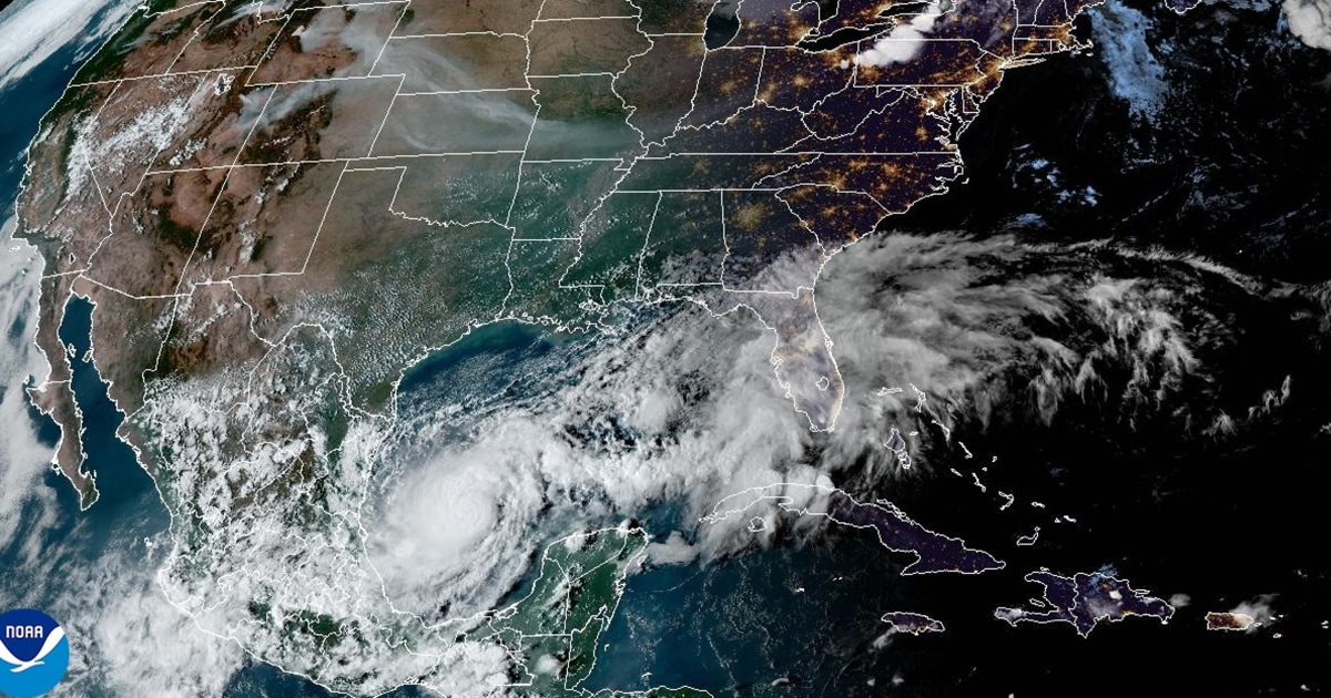
Hurricane Milton is expected to continue to develop rapidly as it soaks up its natural fuel, warm water in the Gulf of Mexico.
In a nighttime bulletin Sunday, the National Hurricane Center said Milton is likely to strengthen into a major hurricane, defined by minimum sustained winds of 111 mph, within 24 hours or so.
NBC News forecasters said Milton could reach Category 4 (with a threshold of 130 mph sustained winds) and weaken back to Category 3 before it makes landfall Wednesday afternoon on the west coast of Florida.
Milton is likely to begin to brush by the top of the Yucatán Peninsula early Monday afternoon, according to the National Hurricane Center.
By the same time Tuesday, the storm is projected to be north of the Yucatán, between Mexico and Cuba, headed east-northeast, according to the center. It could be pushing out sustained winds of 145 mph by them, according to its projections, making it a Category 4 hurricane.
Rain, strong winds and possible storm surges were expected to begin Tuesday night along Florida’s west coast, according to NBC News meteorologists.
Sometime Wednesday afternoon, the storm is expected to make landfall between the Tampa Bay area and Naples as a Category 3 hurricane.
Storm threats
Federal forecasters said Milton would produce life-threatening storm surges along nearly the entire west coast of Florida while also triggering flash floods and producing destructive winds, initially forecast at 111 mph and greater, near its center.
Rain and isolated tornadoes were forecast for areas across the Florida Peninsula on Wednesday night, with the storm pushing east and out into the open Atlantic by Thursday.
Coastal and inland cities, including Tampa, Orlando, Daytona Beach, Sarasota, Fort Myers and Naples, are at risk for significant impacts, including wind-caused power outages, flash flooding and flooding from storm surges, NBC News forecasters said.
Up to 8 inches of rain was forecast, with storm surges of 6 feet and more possible for coastal cities, they said.
Milton’s rare origin
Milton’s rapid rise has jolted a Southeastern region still recovering from Hurricane Helene, which made landfall in Florida’s Big Bend region on Sept. 26 and killed more than 230 people in six states.
The latest hurricane is a rare product of the southwest Gulf of Mexico, rather than the Caribbean or the Atlantic.
Milton started as Tropical Depression 14, in the Gulf’s Bay of Campeche, sheltered behind the western coast of Mexico’s Yucatán Peninsula.
A hurricane taking that path, from the Bay of Campeche to Florida, is exceptionally rare — the last time it was recorded happening was in 1867.
By late afternoon Saturday, Tropical Depression 14 had become Tropical Storm Milton, according to the National Hurricane Center.
By 1 p.m. Sunday, with the storm 290 miles west-northwest of Progreso, it intensified into Hurricane Milton, a Category 1 storm with a minimum of 74 mph sustained winds.


